Ascent route
Voie Major: the grand historic route of the Brenva Face
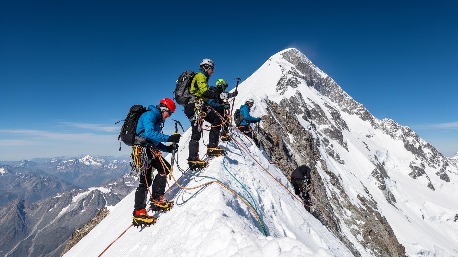
The Voie Major is one of the most committing ascents of Mont Blanc (4,805.59 m — IGN/OGE 2021) and one of the most notable pages in the history of European alpinism. Opened in September 1928 by T. Graham Brown and Frank Smythe on the Brenva Face, Italian side, it traces an almost direct line to the summit over ~1,000 m of a wall exposed to seracs, rated TD on the ENSA/FFCAM scale. It is a benchmark route for expert alpinists seeking a historic, committing itinerary.
Written by Victor Michel — history enthusiast and passionate alpinist based in Chamonix. Published May 7, 2026 · Updated August 26, 2026 · 10 min read
Quick summary
The Voie Major (TD) starts from the Eccles Bivouac (FFCAM, 3,850 m) or the Monzino Refuge (CAI, 2,590 m), Italian side, accessible from Courmayeur. It climbs a long snow-and-ice couloir before tackling steep mixed passages (55°–60°) to reach Mont Blanc's summit ridge. Typical duration from the Eccles Bivouac: 8 to 12 hours for a very experienced rope team. The descent is mandatory via the Goûter route (French side).
Key takeaways
- First ascent: T. Graham Brown + Frank Smythe — September 2, 1928 (35 h from the foot of the face)
- Grade TD (Très Difficile / Very Difficult) — ENSA/FFCAM — passages at 55°–60° on bare ice
- Start: Eccles Bivouac (FFCAM, 3,850 m) or Monzino Refuge (CAI, 2,590 m), Italian side
- Elevation gain from Eccles Bivouac: ~1,000 m to the summit (4,805.59 m IGN/OGE 2021)
- Key passage: active serac zone to cross before 8am solar time — no delay allowed
- No retreat possible beyond the first third of the route — total commitment
- Descent: mandatory via the Goûter route (French side) — the Brenva cannot be down-climbed
Technical data
- SideItalian — Val Vény (Courmayeur, Aosta, Italy)
- AccessMont Blanc Tunnel (Chamonix–Courmayeur, ~45 min, toll ~€25) + Val Vény + Monzino Refuge (2,590 m) + Eccles Bivouac (3,850 m)
- Starting campEccles Bivouac (FFCAM, unguarded, ~15 spots) at 3,850 m — or Monzino Refuge (CAI, 2,590 m) if the bivouac is full
- Summit altitude4,805.59 m (official IGN/OGE measurement 2021)
- Route elevation gain~1,000 m (bergschrund ~3,800 m → summit 4,805.59 m)
- GradeTD (Très Difficile / Very Difficult) — ENSA/FFCAM — passages at 55°–60° on ice
- Ascent time8 to 12 h from the Eccles Bivouac · 12 to 18 h from the Monzino Refuge
- First ascentT. Graham Brown + Frank Smythe — September 2, 1928 (35 h from the face to the summit)
- Best seasonMid-June to end of July — supportive snow, relatively stable seracs
- ReturnNormal Goûter route on the French side — Dôme du Goûter (4,304 m) → Goûter Refuge (3,835 m) → Mont Blanc Tramway
Voie Major Itinerary — Day by Day
Day −1 — Approach and night at altitude
Courmayeur → Monzino Refuge (CAI, 2,590 m) → Eccles Bivouac (FFCAM, 3,850 m). From Courmayeur or La Visaille (head of Val Vény), climb the Miage Glacier to the Monzino Refuge (3.5–4 h). Well-trained rope teams push directly on to the Eccles Bivouac (4 to 6 additional hours on the Brouillard Glacier). The Eccles Bivouac — unguarded, ~15 spots, managed by the FFCAM — sits at the Col de l'Innominata (3,850 m). Its high position reduces the remaining elevation gain to the summit to ~1,000 m. A short night is essential: departure planned between midnight and 2am.
Summit Day — From the Voie Major to the top (night departure)
Eccles Bivouac (3,850 m) → Foot of the face (~3,950 m) — 30 to 45 min. The rope team descends slightly from Eccles to reach the bergschrund of the Route Major. Under nighttime freeze conditions, this glacier crossing is done on supportive snow. This is the only favorable window before the sun warms the overhanging seracs — any delay here can jeopardize the rest. Foot of the face → First technical zone — 2 to 3 h. The Voie Major first climbs a snow couloir inclined 40°–45° over roughly 300 m. Roped progression with 12-point crampons and an ice axe is essential. Snow frozen overnight offers the best conditions — fresh powder or softened snow significantly increases avalanche risk and slows progression. Serac zone and mixed passages (upper section) — 3 to 5 h. The central section crosses an active serac zone: fast progression is required, the rope team does not stop. Mixed passages (rock and ice) reach 55°–60° over several pitches. Placing ice screws and mastering ice-tool dry-tooling technique are non-negotiable. T. Graham Brown and Frank Smythe took 35 h on the first ascent in 1928 — modern conditions, with a thinner snowpack, make some passages even trickier than in their era. Summit ridge → Mont Blanc (4,805.59 m) — 1 to 2 h. Once the summit ridge is reached (~4,600–4,700 m), technical difficulty eases considerably. The rope team joins the summit via the Bosses Ridge, shared with the Goûter normal route. At the summit, the descent begins immediately via the Goûter route: Dôme du Goûter (4,304 m), Goûter Refuge (3,835 m), Mont Blanc Tramway from Nid d'Aigle (2,412 m), or on foot down to Les Houches.
Physical level
Elite physical level. The Voie Major involves 12 to 18 h of continuous effort above 3,800 m, with technical passages in the second half of the day — when fatigue and hypoxia reduce capacity by 20 to 30% according to ENSA data. The recommended preparation profile includes: several 4,000 m climbs in the Alps (including at least one graded AD or higher), 8 to 10 h/week of cardiorespiratory training over 6 months, and at least one night spent above 3,500 m before the ascent.
Technical level
Expert technical level. Graded TD (Très Difficile / Very Difficult) on the ENSA/FFCAM scale. The route requires: 12-point crampons with perfect mastery on steep terrain (up to 60°), autonomous dry-tooling technique, placing and retrieving ice screws, mixed-terrain progression (rock + ice) at night, alpine rappelling. No fixed gear is pre-installed on this route — all protection is the rope team's own responsibility.
Difficulty details
The Voie Major combines four complementary sources of difficulty: (1) sustained slope over ~1,000 m of elevation gain (40° to 60° depending on the section) with no significant rest zone; (2) isolation — no retreat possible beyond the first third of the route, the summit is the only way out; (3) seracs — an active fall zone that must be crossed before 8am solar time; (4) altitude — the hardest passages occur between 4,200 and 4,700 m, where the partial pressure of oxygen is 40 to 45% lower than at sea level (ENSA source). Since the route opened in 1928, the Brenva Glacier has lost ~30% of its surface area (CNRS data), exposing more bare rock and ice.
Specific risks
- Active seracs — must be crossed before 8am solar time; any delay makes progression dangerous
- Rockfall — released by thaw; helmet mandatory for the entire route
- Total commitment — no retreat past the first third; only the summit allows an exit via the Goûter
- Bare ice — reduced snow cover since 2000; two ice axes and 4+ ice screws essential
- Nighttime hypothermia — temperatures between −15°C and −25°C at 4,000 m in summer; high-altitude clothing mandatory
- Nighttime disorientation — unmarked route; GPS with pre-loaded waypoints essential
Huts and key points
- Monzino Refuge (CAI) — 2,590 m — Val Vény (Italy) — ~70 spots, staffed mid-June to mid-September — booking mandatory
- Eccles Bivouac (FFCAM) — 3,850 m — Col de l'Innominata — ~15 spots, unguarded, open in summer season
- Goûter Refuge (FFCAM) — 3,835 m — French side — for the descent after the ascent
Recommended equipment
- 12-point anti-snow crampons (rigid automatic binding) — mandatory
- Two ice axes (classic + technical dry-tooling type) — mandatory on the upper section (55°–60°)
- 60 m double rope — rappels possible in case of partial retreat or depending on conditions
- Ice screws (4 minimum) — bare-ice terrain on the upper section, secure anchors
- Helmet — mandatory (seracs + rockfall)
- Harness + rappel gear (belay device, prusik cord, HMS carabiners)
- High-altitude down jacket + waterproof windbreaker — for emergency insulation at the bivouac, French brands like Cimalp offer natural 800-fill-power down jackets weighing no more than 285 g
- Merino wool thermal base layer + fleece midlayer + hardshell mountaineering pants
- Rigid double or single-shell mountaineering boots (crampon-compatible soles)
- Headlamp + spare batteries — systematic night departure
- Food for 24 to 36 h (no resupply on the face), water + purification tablets
- GPS + IGN 1:25,000 map (Mont Blanc Italian side section) — pre-loaded with waypoints
- Medical kit including AMS medication (acetazolamide by prescription) + painkillers
Who is this route for?
Expert alpinists who have completed several AD/D climbs in the Alps (Mont Blanc via the Goûter route, the Three Peaks traverse or equivalent), with perfect mastery of ice and mixed climbing techniques, comfortable with autonomous night progression. The Compagnie des Guides de Chamonix and the SNGM consistently recommend hiring a UIAGM/IFMGA mountain guide for a first attempt on the Voie Major.
When to avoid this route
Unstable weather conditions (wind > 50 km/h at 4,000 m, storm probability > 20% within 24 h per Météo-France). Post-heatwave period (weakened seracs, increased bare ice). First high-mountain experience or first night above 3,000 m. Lack of mastery of any of the mandatory techniques (crampons, ice screws, second ice axe, alpine rappelling).
Alternatives
Frequently asked questions
Sources
- IGN / OGE — Official Mont Blanc summit measurement: 4,805.59 m (2021)
- FFCAM — Grandes Alpes Topo-guide (Mont Blanc, Brenva sector)
- ENSA (École Nationale de Ski et d'Alpinisme, Chamonix) — Alpinism technical reference
- T. Graham Brown — 'Brenva' (1944) — account of the first ascent of the Voie Major (1928)
- PGHM Chamonix — Mountain safety bulletins 2025
- CNRS / Glaciology Laboratory — Brenva Glacier retreat data (1980–2023)
- Compagnie des Guides de Chamonix — 2026 conditions and route reports
Other ascent routes
Going further
Safety: Conditions in the high mountains change rapidly. The information on this page replaces neither the judgement of a high-mountain guide, nor weather bulletins, nor official information from huts and mountain safety organisations.