Ascent route
Brenva Face: historic alpine routes on Mont Blanc
The Brenva Face is one of the most mythical slopes in European alpinism. On the Italian flank of Mont Blanc (4,805.59 m — IGN/OGE 2021), it brings together several major routes opened between 1865 and 1928, all graded D to TD, in an environment of total commitment and isolation characteristic of the Italian side. It is here that high alpine mountaineering has written some of its most emblematic pages.
Written by Victor Michel — history enthusiast and passionate alpinist based in Chamonix. Published May 7, 2026 · Updated August 26, 2026 · 9 min read
Quick summary
Italian side accessible from Courmayeur (Italy) via the Mont Blanc Tunnel or Col du Géant. Monzino Refuge (CAI, 2,590 m) or Eccles Bivouac (3,850 m) used as base camps. Main routes: Brenva Route (1865, AD+/D, first ascent of the face), Major Route (1928, TD, Graham Brown & Smythe), Red Sentinel (D). Reserved for highly experienced rope teams with technical mastery in mixed conditions.
Key takeaways
- Italian side of Mont Blanc — access from Courmayeur (Italy), 2 hours from Chamonix via Mont Blanc Tunnel
- Total face elevation gain: ~2,000 m from Aosta Valley to summit (4,805.59 m IGN/OGE 2021)
- 3 major routes: Brenva Route (1865), Major Route (1928), Red Sentinel (D)
- Grades AD+/D to TD (ENSA/FFCAM) — no route below AD+ on this face
- Base camp: Monzino Refuge (CAI, 2,590 m) or Eccles Bivouac (FFCAM, 3,850 m) depending on route
- Maximum commitment: no possibility of quick retreat once beyond the first third
- First ascent of the face: Mathews, Moore, Walker and guide Jakob Anderegg — July 15, 1865
Technical data
- FaceItalian — Courmayeur / Val Vény (Aosta, Italy)
- AccessCourmayeur (1,224 m) via Mont Blanc Tunnel (Chamonix–Courmayeur, ~45 min, toll ~€25) or Col du Géant
- Base campMonzino Refuge (CAI, 2,590 m) or Eccles Bivouac (FFCAM, 3,850 m) depending on chosen route
- Summit altitude4,805.59 m (official measurement IGN/OGE 2021)
- Total elevation gain~2,000 m (valley floor → summit) · ~1,000 m (bergschrund ~3,800 m → summit)
- GradesAD+/D (Brenva Route) · D (Red Sentinel) · TD (Major Route) — ENSA/FFCAM
- Main routesBrenva Route (1865), Major Route (1928), Red Sentinel
- Optimal seasonMid-June to late July for supportive snow; after mid-August: increased risk of rockfall
- Typical duration2 to 3 days depending on route (approach + night ascent + descent French side)
- DescentNormal Goûter Route (French side) — descent in 3–5 h to Saint-Gervais or Les Houches
Access and logistics
Day 1 — Approach from Courmayeur to Monzino Refuge
Courmayeur (1,224 m) → Monzino Refuge (CAI, 2,590 m) — 3.5 to 4 hours walking. From Courmayeur or La Visaille (head of Val Vény), the trail ascends the Miage Glacier and reaches Monzino Refuge, property of the Italian Alpine Club (CAI). Staffed during season (mid-June to mid-September), approximately 70 beds. Reservation mandatory via CAI Courmayeur section. It is the historic base camp for the major Brenva routes and the Innominata/Frêney side.
High alternative: Eccles Bivouac (FFCAM, 3,850 m). For the highest routes (Major Route, Red Sentinel), some rope teams prefer to reach Eccles Bivouac directly from Monzino Refuge (4 to 6 additional hours on Brouillard Glacier). Eccles Bivouac, unstaffed and managed by FFCAM (~15 beds), sits at Col de l'Innominata (3,850 m). It allows starting at night with only ~1,000 m elevation gain to the summit.
Day 2 — The face: night ascent
Departure between midnight and 3 AM depending on route and refuge. All Brenva routes require a night departure to: (1) cross the bergschrund zone and seracs in frozen hard snow; (2) limit ice and rockfall melted by daytime heat; (3) reach the summit (4,805.59 m) before afternoon convective storms. The face covers about 1,000 m of elevation from the bergschrund (~3,800 m) to the summit ridge. The fastest routes in excellent conditions allow reaching the summit in 5 to 8 hours from Eccles Bivouac (Brenva Route), or 8 to 12 hours for the Major Route.
Day 3 — Descent via the Goûter Route (French side)
Summit → Goûter Refuge (3,835 m) → Saint-Gervais or Les Houches. All Brenva ascents include descent via the normal Goûter Route, on the French side, because the Brenva Face cannot be down-climbed — mountain logic dictates it. You must therefore plan descent via Goûter Dome (4,304 m), Goûter Refuge (3,835 m), and reach the Mont Blanc tramway at Nid-d'Aigle (2,412 m) or walk down to Les Houches. This two-valley logistics (Courmayeur → Chamonix) requires arranging a vehicle drop-off or organizing return transportation in advance.
Physical level
Exceptional physical fitness required. All Brenva routes demand 2 to 3 days of continuous effort (approach, night at altitude, night ascent, descent). Rope teams must have validated several 4,000 m peaks in the Alps (Breithorn, Gran Paradiso, Bishorn or equivalent), an ascent of Mont Blanc via a more accessible route, and at least one night in a high altitude refuge. ENSA recommends 8 to 12 hours of cardio-mountaineering training per week over 4 to 6 months of preparation.
Technical level
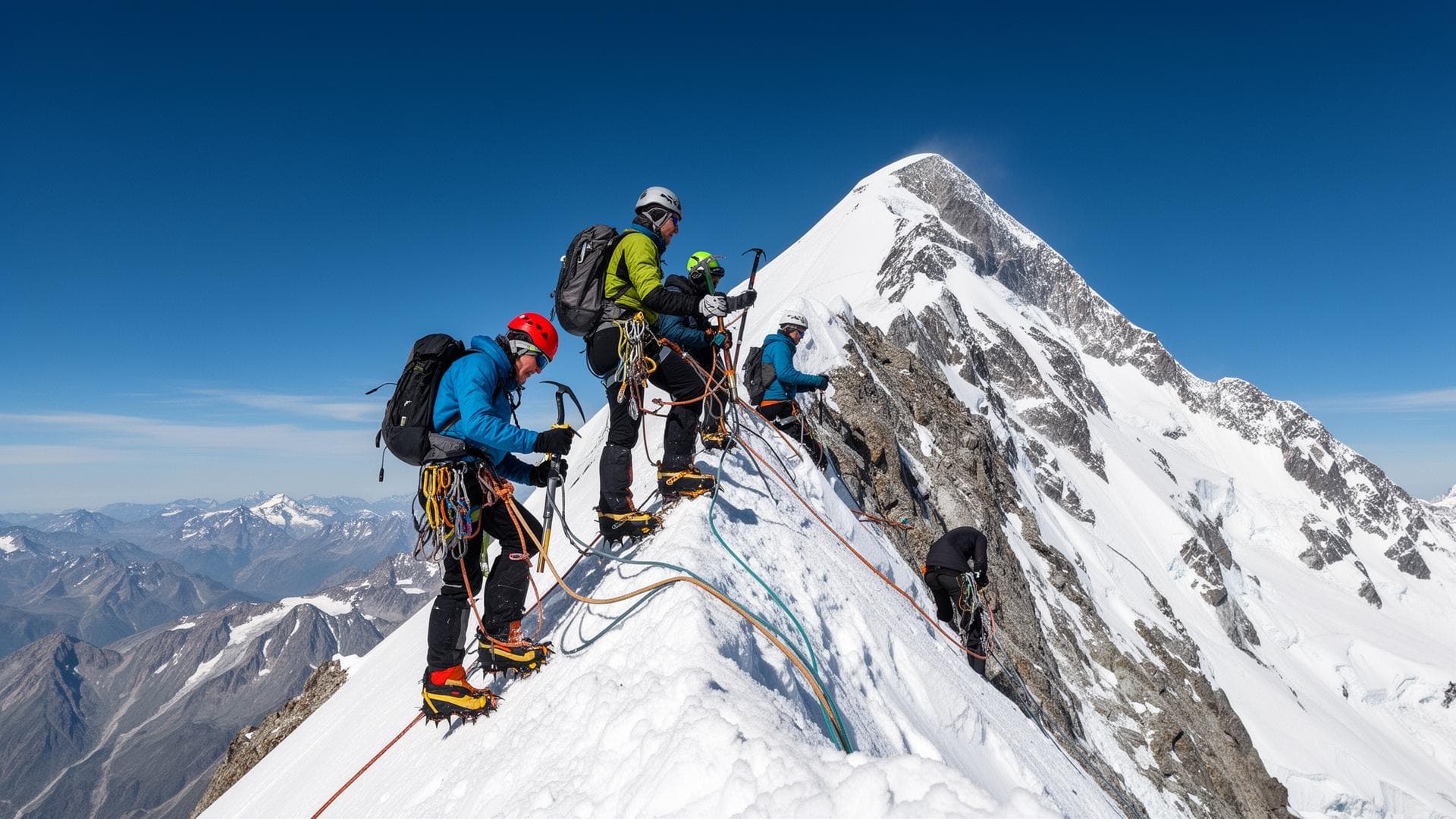
Advanced to expert technical level. Grades AD+/D to TD depending on route. Essential mastery: 12-point crampons on ice and mixed terrain, ice axe climbing on steep pitches (40°–60°), autonomous placement and retrieval of ice screws, mixed terrain progression (rock + ice), rappels in night alpine conditions. The Major Route (TD) involves steep ice passages over several consecutive pitches with no retreat option.
Difficulty details
Three factors aggravate technical difficulty on Brenva: (1) total isolation — no easy retreat beyond the first third of the route, the summit is the only viable exit; (2) changing conditions — the face experiences seasonal thaw since the 2000s, making seracs less stable and thin ice more frequent; (3) altitude — technical passages occur between 4,000 and 4,700 m, where partial pressure of O₂ is reduced 40 to 45% compared to sea level (ENSA). The Brenva Glacier has lost approximately 30% of its surface since the 1980s (CNRS data).
Specific risks
- Serac fall — active zone particularly late in season (August–September); cross quickly before 8 AM solar time
- Rockfall — accelerated by climate change; helmet mandatory over entire face
- Isolation — no possibility of quick retreat beyond the first third; the summit is the only viable exit
- Thin ice conditions — reduced snow cover since the 2000s; 12-point crampons + two ice axes essential
- Sudden weather — check Météo-France mountain bulletin + MeteoBlue + PGHM Chamonix bulletin before departure
- Night disorientation — sparsely marked face; GPS with pre-registered Eccles Bivouac and bergschrund coordinates essential
Huts and key points
- Monzino Refuge (CAI) — 2,590 m — Val Vény, Courmayeur (Italy) — ~70 beds, staffed mid-June to mid-September — reservation mandatory
- Eccles Bivouac (FFCAM) — 3,850 m — Col de l'Innominata — ~15 beds, unstaffed, open summer season
- Goûter Refuge (FFCAM) — 3,835 m — French side — ~120 beds, staffed June–September — for descent after summit
Recommended equipment
- 12-point crampons anti-balling (automatic) — mandatory over entire face
- Two ice axes (classic + technical ice climbing axe) — recommended for Major Route and Red Sentinel
- Double rope 60 m (or 2×50 m) — rappels possible depending on route and conditions
- Ice screws (4 minimum) — for anchors and protection on thin ice passages
- Helmet — mandatory (serac and rockfall hazard)
- Harness + complete rappelling kit (rappel device, ascender, HMS carabiners)
- Down insulated parka high altitude + waterproof windshell
- Thermal base layer merino wool + insulation layer fleece + alpine shell pants
- Alpine boots double or rigid mono-shell (cramponing sole mandatory)
- Headlamp with fresh batteries — systematic night departure
- Food for 2–3 days (face not equipped with resupply), water + purification tablets
- GPS with pre-registered Eccles Bivouac and main itinerary waypoint coordinates
- First aid kit including medication for altitude sickness (acetazolamide on medical prescription)
Who is this route for?
Experienced alpinists having validated several 4,000 m peaks in the Alps (including at least one Mont Blanc ascent via the Goûter route), mastering advanced ice techniques and autonomous night progression. Ideally accompanied by a high altitude mountain guide (UIAGM/IFMGA) for a first time on this face — Chamonix Guides Company and SNGM formally recommend it.
When to avoid this route
Unstable weather forecast (wind > 40 km/h at 4,000 m or storm probability > 30% per Météo-France). After an extended heat spell (seracs weakened). First high altitude mountaineering experience or lack of rappelling mastery in alpine conditions. Lack of cramponing experience on slopes > 45°.
Alternatives
Frequently asked questions
Sources
- IGN / OGE — Official Mont Blanc summit measurement: 4,805.59 m (2021)
- FFCAM — Guide to the Major Alps (Mont Blanc sector, Italian side)
- ENSA (National School of Skiing and Mountaineering, Chamonix) — Alpine mountaineering technical reference
- T. Graham Brown — 'Brenva' (1944) — historic account of the first Major Route
- PGHM Chamonix — Mountain safety bulletins (2025 season)
- CAI (Italian Alpine Club) — Monzino Refuge information and Val Vény access
- CNRS / Glaciology Laboratory — Brenva Glacier retreat data (1980–2023)
- Chamonix Guides Company — Grades and conditions data 2026
Other ascent routes
Going further
Safety: Conditions in the high mountains change rapidly. The information on this page replaces neither the judgement of a high-mountain guide, nor weather bulletins, nor official information from huts and mountain safety organisations.