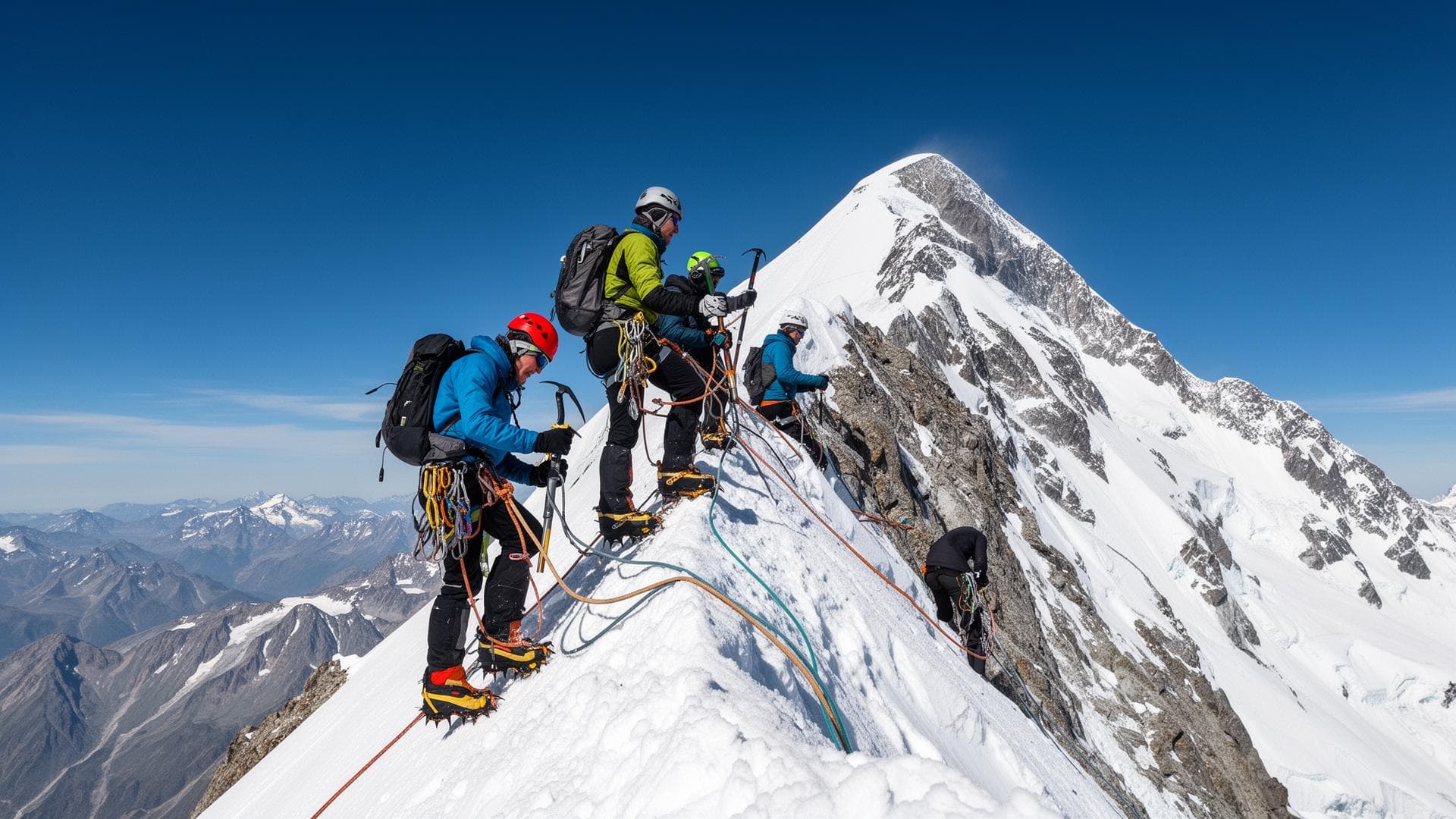
Matterhorn (4,478 m): Hörnli normal route, required level and acclimatization
Written by Victor Michel — history enthusiast and passionate alpinist based in Chamonix. Published September 26, 2026 · Updated November 4, 2026
The Matterhorn normal route follows the Hörnli ridge, graded AD, with compulsory rock climbing up to grade 3. The Compagnie des Guides de Chamonix allows 8 to 10 hours for the hut-to-hut round trip and runs the climb with one participant per guide.
Key takeaways
- Summit altitude: 4,478 m on the Swiss national map at 1:10,000 by swisstopo
- Normal route by the Hörnli ridge, graded AD, commitment grade III, protection grade P2 according to Camptocamp
- 1,220 m of elevation gain between the Hörnli Hut and the summit
- 8 to 10 hours for the hut-to-hut round trip, according to the Compagnie des Guides de Chamonix
- Hörnli Hut: 150 beds, open from 25 June to 18 September for the 2027 season
- First ascent on 14 July 1865 by Edward Whymper's rope team, four dead on the descent
What is the official altitude of the Matterhorn?
The Swiss national map at 1:10,000, published by swisstopo, gives 4,478 m. The geodetic measurement gives 4,477.54 m, a value recorded by Leica Geosystems and entered on Wikidata. The summit stands on the border between the canton of Valais and the Aosta Valley, at 45.976° north latitude and 7.659° east longitude. It belongs to the Pennine Alps, a range separate from the Mont Blanc massif.
The first ascent of 14 July 1865 and the accident on the descent
Seven climbers reached the summit on 14 July 1865 at 1:40 pm: Edward Whymper, Charles Hudson, Francis Douglas, Douglas Hadow, the Chamonix guide Michel Croz and the two Peter Taugwalders, father and son. On the descent, above the Shoulder, Hadow slipped and dragged Croz down with him, then Hudson and Douglas. The rope linking Douglas to Taugwalder senior broke, which saved the last three from being pulled off and left four dead at the foot of the north face. Zermatters, the Zermatt guides' office, sums up the day by writing that twenty minutes separated triumph from disaster. Three bodies were found on the Matterhorn glacier on 19 July, Francis Douglas's never.
The Hörnli Hut: altitude, beds and booking conditions
The Hörnli Hut stands at 3,260 m, at the foot of the ridge, and advertises 150 beds for the night and 130 seats in the restaurant. Zermatters dates its construction to 1880. The operator announces an opening from 25 June to 18 September for 2027, and only opens bookings on 1 April of the season's year. Rooms have 8 beds at most, a sleeping bag liner is compulsory, arrival is at 2 pm and departure at 9 am.
Elevation gain, duration and breakdown of the climb
1,220 m of elevation gain separate the hut from the summit, 1,200 m of it in the difficulties according to Camptocamp. The timing of the ascent breaks down into about 1 hour from the hut to the tower known as auf dem Grat, 1 hour to 1 hour 30 to the Solvay Hut, then 1 hour to 1 hour 15 in the fixed ropes of the final step. Zermatters gives about four hours for the ascent alone. The route record belongs to Andreas Steindl, in 3 h 59 min 52 s round trip from Zermatt's Kirchplatz, which has no bearing on the timing of a guide-and-client rope team.
The Solvay Hut, 4,003 m: an emergency shelter, not a stage
The Solvay Hut sits on the ridge 743 m above the Hörnli Hut. The Swiss Alpine Club, owner through its Bern section, reserves its use for emergencies: ten places, no warden, an emergency radio powered by a solar panel. It was inaugurated on 8 August 1917. Wikipedia counts 400 to 600 climbers stopping there each year, only 30 to 40 of them in real difficulty.
What level is needed for the Hörnli ridge?
The Compagnie des Guides de Chamonix asks for prior experience of rock and mixed routes graded PD+ to AD−, with grade 4 climbing, and a physical condition able to sustain 10 to 12 hours of effort a day. The grade does not sum up the commitment. Camptocamp points out that the main difficulty lies in route-finding in the first half, covered at night, and that the quality of the rock deteriorates as soon as you leave the route. Fixed ropes equip the hardest passages, and the route ends on a snow slope at 40°. Every step climbed has to be down-climbed the same day.
What acclimatization before the Matterhorn?
The programme of the Compagnie des Guides de Chamonix devotes two days of acclimatization climbs before the Matterhorn, from the Pointe Helbronner and with a night at the Torino Hut (3,370 m), then a reserve day for weather or recovery. The walk up to the Hörnli Hut takes another 2 h 30, and the summit is attempted the next morning. Five days for a climb that lasts one.
What separates the Hörnli from the Goûter normal route
The Hörnli requires compulsory rock climbing, the Goûter route does not. Graded PD−, the normal route up Mont Blanc is a snow and glacier climb. It calls for crampons, an ice axe and roped travel, but has no rock step to climb and then down-climb. A climber who has climbed Mont Blanc by the Goûter has validated altitude and endurance, not the technical level of the Matterhorn.
Matterhorn by the Hörnli and Mont Blanc by the Goûter: what changes
The two routes are the normal routes of their summits, and that is about all they share. The Hörnli data come from Camptocamp, the hut operator and the Compagnie des Guides de Chamonix. The Goûter data reuse the sheet for that route published on this site.
| Criterion | Matterhorn, Hörnli ridge | Mont Blanc, Goûter route |
|---|---|---|
| Summit altitude | 4,478 m (Swiss national map) | 4,807.47 m (Haute-Savoie surveyors, 2026) |
| Overall grade | AD | PD− |
| Compulsory rock climbing | Yes, up to grade 3 | No |
| Dominant terrain | Rock and mixed | Snow and glacier |
| Starting hut | Hörnli, 3,260 m, 150 beds | Goûter, 3,835 m, 120 beds |
| Elevation gain from hut to summit | 1,220 m | About 970 m |
| Length of summit day | 8 to 10 hours hut to hut | 4 to 6 hours up, 3 to 4 hours down |
Sources and resources
Read next
- → Breithorn: a grade F 4,000 m peak above Zermatt
- → Monte Rosa (4,634 m): Dufourspitze, huts and preparation climb
- → Goûter normal route: PD− grade and complete itinerary
- → Altitude, acclimatization and mountain sickness
- → Pointe Helbronner: the starting point for acclimatization climbs
- → Am I ready? Assessing your mountaineering level
- → Find a UIAGM high mountain guide
FAQ
What is the exact altitude of the Matterhorn?
4,478 m on the Swiss national map at 1:10,000 by swisstopo. The geodetic measurement gives 4,477.54 m.
What is the grade of the Matterhorn normal route?
AD, with compulsory rock climbing up to grade 3. Camptocamp adds a commitment grade III and a protection grade P2.
How long does it take to climb the Matterhorn by the Hörnli ridge?
8 to 10 hours for the round trip from the Hörnli Hut, according to the Compagnie des Guides de Chamonix.
How many clients does a guide take on the Matterhorn?
One participant per guide, according to the Compagnie des Guides de Chamonix.
How do you book the Hörnli Hut?
The operator only opens bookings on 1 April of the season's year, on its website.
Can you sleep at the Solvay Hut, at 4,003 m?
No, the Swiss Alpine Club reserves its use for emergencies. The hut is not staffed.
Who made the first ascent of the Matterhorn and what happened on the descent?
Seven climbers led by Edward Whymper, on 14 July 1865. On the descent, a fall followed by the breaking of the rope left four dead.
Is the Matterhorn harder than Mont Blanc by the Goûter route?
Technically yes, AD with compulsory rock climbing against PD− with no rock step to climb. Mont Blanc remains higher and more demanding in pure altitude.